Army Trialling UAS-Mounted LiDAR for Enhanced Surveying Capabilities
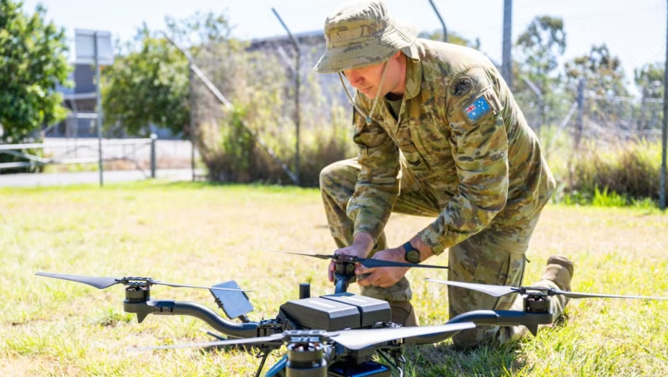
Australian Army soldier Corporal Sam Kelly prepares an uncrewed aerial system with a mounted light detection and ranging unit for a test flight at Gallipoli Barracks, Brisbane. (Image: LCPL Luke Donegan)
The Australian Army is conducting a trial with an uncrewed aerial system (UAS) equipped with LiDAR (Light Detection and Ranging) technology, aiming to transform the way it conducts land surveys. Traditionally, military surveying methods rely on ground-based techniques, limiting the scope and speed of data collection and often exposing personnel to hazards like wildlife, rough terrain, and potential enemy threats.
With the integration of LiDAR on UAS, surveyors can gather detailed spatial data across vast areas in less time while enhancing safety by removing personnel from direct exposure to these risks. This airborne LiDAR system emits rapid pulses of laser light, roughly 300,000 per second, measuring distances by tracking how long it takes each laser pulse to reflect back. “This data allows us to create accurate 3D models of the terrain and any objects on it, like buildings or vehicles,” said Corporal Sam Kelly, a surveyor involved in the trial.
Mounted on an American-made UAS for the trial, the LiDAR unit can also function in handheld mode for confined areas or be mounted on vehicles in no-fly zones. According to Corporal Kelly, the new system has demonstrated significant advantages over existing methods. “In just 20 minutes, the UAS-mounted LiDAR can scan 20,000 square meters,” Kelly explained, “a task that would take us an entire eight-hour day with traditional systems. Plus, surveying from above gives us easy access to building rooftops and difficult terrain.”
The UAS-mounted LiDAR also excels in surveying dense, vegetated areas. Ground-based equipment struggles in such conditions, often requiring multiple setups to bypass tree canopies and other obstructions. With LiDAR on a UAS, surveyors can scan from above the tree line, capturing enough data to produce accurate terrain maps. “Even though you won’t see every centimetre of the ground under thick vegetation, you get a comprehensive view of the terrain that’s often just as reliable as if you walked the site with traditional tools,” Kelly added.
The concept for UAS-mounted LiDAR in Defence settings originated from Lance Corporal Michael Raymont of the 19th Chief Engineer Works, who proposed the idea after seeing the benefits of drones in challenging environments. Raymont noted that on a recent deployment to Papua New Guinea, he collected extensive data in mere hours using a drone, a task that would otherwise have taken days with conventional methods. “This technology is a game-changer,” he said, emphasizing how critical it could become in military surveying efforts.
As Defence nears the completion of this trial, the promising results suggest UAS-mounted LiDAR could soon be a core tool, enabling faster, safer, and more comprehensive surveys across diverse and often inaccessible terrains.


